- _CLIMATE OF ARIZONA
TOPOGRAPHIC FEATURES – Arizona covers 113,909
square miles, with about 350 square miles of water surface. The
state has three main topographical areas: (1) a high plateau Yuma, Arizona - Monthly Climate
Normals
Year
Feb.
Mar
Apr.
May
Jun.
Jul.
Aug.
Sep
Oct.Desert Climates
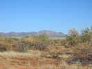
Desert climates are found in Central and
Southern Arizona, including the metro areas around Tucson and Phoenix. The
average elevation in desert climates is 1200 feet.
Month
Average Low
Average High
Rainfall
January
41.2F/5.1C
65.9F/18.8C
0.6"
February
44.7F/7C
70.7F/21.5C
0.7"
March
48.8F/9.3C
75.5F/24.2C
0.9"
April
55.3F/12.9C
84.5F/29.2C
0.22"
May
63.9F/12.9C
84.5F/29.2C
0.22"
June
72.9F/22.7C
103.5F/39.7C
0.1"
July
81.0F/27.2C
105.9F/41.1C
0.1"
August
79.2F/26.2C
103.7F/39.8C
0.9"
September
72.8F/22.6C
98.3F/36.8C
1.0"
October
60.8F/16C
88.1F/31.2C
0.86"
November
48.9F/9.4C
74.9F/23.8C
0.7"
December
41.8F/5.4C
66.2F/19C
1.0"
Nov.
Dec.
High °F
87.9
68.7
74.4
78.9
86.3
94.2
103.3
106.6
105.3
100.5
90.3
77.4
68.5
Low °F
60.5
44.2
46.9
50.8
56.5
63.8
72.0
80.7
80.1
73.2
62.2
50.9
44.3
Avg °_
74.2
56.5
60.7
64.9
71.4
79.0
87.6
93.7
92.7
86.8
76.2
64.2
56.4
Rain "
3.17
0.35
0.22
0.21
0.14
0.04
0.02
0.26
0.64
0.31
0.29
0.24
0.45 - _
Think about the environment before you
PRINT!
Reduce, Reuse, Recycle
USD 204 Schools
Bonner Springs /
Edwardsville - Kansas
A 21st Century Quality Education is Our
Business
Continuous Improvement is Our Goal
www.usd204.org
averaging between 5,000 and 7,000 feet in elevation in the northeast;
(2) a mountainous region oriented southeast to northwest with maximum
elevations between 9,000 and 12,000 feet about mean sea level; and (3) low
mountain ranges and desert valleys in the southwestern portion of the
state. From the White Mountain area across the Mogollon Rim to the
San Francisco Peaks lies an unbroken stand of Ponderosa Pine. The
Kaibab Plateau north of the Grand Canyon continues this timbered strip into
southern Utah.The highest point in the state is Humphreys Peak,
located northwest of Flagstaff, with an elevation of 12,611 feet.
Baldy Peak, in the White Mountains of eastern Arizona, is the second
highest in the state with an elevation of 11,490 feet. The desert
valleys of southwestern Arizona are an extension of the Sonora Desert of
Mexico, with elevations as low as about 100 feet above sea level in the Lower
Colorado River Valley.
The higher elevations of the
state, running diagonally from the southeast to the northwest, average between
25 and 30 inches of precipitation (rain plus melted snow) annually, while the
desert southwest averages as low as three or four inches per
year.The plateau country in the northeastern corner of the state
receives approximately 10 inches of precipitation annually. Since
vegetation in this area consists of sagebrush and native grasses, it is used
primarily for grazing. Higher ridges here are covered with
junipers and pinion trees.
Nearly the entire state is
in the Colorado River drainage basin which empties into the Gulf of
California. The world famous Grand Canyon lies within the state,
extending southwestward some 217 miles from the junction of the Little Colorado
with the main stream. The Grand Canyon varies in width from 4 to
18 miles, and depths from the rim to the river bed range from 2,700 to as much
as 5,700 feet. This is an outstanding example of arid or semiarid
land erosion by a major river whose source is in a more rainy area.
TEMPERATURE – Cold
air masses from Canada sometimes penetrate into the state, bringing
temperatures well below zero in the high plateau and mountainous regions of
central and northern Arizona. The lowest readings can dip to 35
degrees F below zero. High temperatures are common throughout the
summer months at the lower elevations. Temperatures over 125
degrees F have been observed in the desert area. Great extremes
occur between day and night temperatures throughout Arizona. The
daily range between maximum and minimum temperatures sometimes runs as much as
50 to 60 degrees F during the drier portions of the year. During
winter months, daytime temperatures may average 70 degrees F, with night
temperatures often falling to freezing of slightly below in the lower desert
valleys.In the summer the pine-clad forests in the central part of
the state may have afternoon temperatures of 80 degrees F, while night
temperatures drop to 35 or 40 degrees F.
The length of the growing
season (period between freezes) varies tremendously over Arizona, averaging
less than three months in some of the higher areas in the northern and eastern
portions of the state. On the other hand, lower desert valleys
sometimes have several years in succession without freezes.
PRECIPITATION –
Precipitation throughout Arizona is governed to a great extent by elevation and
the season of the year. From November through March, storm systems
from the Pacific Ocean cross the state. These winter storms occur
frequently in the higher mountains of the central and northern parts of the
state and sometimes bring heavy snows. Snow accumulation may rach
depths of 100 inches or more during the winter. The gradual
melting of this snow during the spring serves to maintain a supply of water in
the main rivers of the state. Reservoirs on these streams supply
water to the desert areas in the lower Salt River Valley and the lower Gila
River Valley areas, which are extensively farmed.
Summer rainfall begins early
in July and usually lasts until mid-September. Moisture-bearing
winds sweep into Arizona from the southeast, with their source region in the
Gulf of Mexico. Another important source of moisture for southern
Arizona is the Gulf of California. Summer rains occur in the form
of thunderstorms which result largely from excessive heating of the ground and
the lifting of moisture-laden air along main mountain ranges.
Thus, the heaviest thunderstorms are usually found in mountainous
regions of the central and southeastern portions of Arizona. These
thunderstorms are often accompanied by strong winds and brief periods of
blowing dust prior to the onset of rain. Hail occurs rather
infrequently.
The average number of days
with measurable precipitation per year varies from near 70 in the Flagstaff
area to 15 at Yuma. A large portion of Arizona is classed as
semiarid and long periods often occur with little or lno precipitation.
The air is generally dry and clear, with low relative humidity and a
high percentage of sunshine. April, May and June are the months
with the greatest number of clear days, while July and August, as well as
December, January and February have the cloudiest weather and lowest percent of
possible sunshine. Humidities, while low when compared to most
other states, are higher throughout much of Arizona during July and August,
which is the thunderstorm season. Annual average humidity values
based on four readings per day range from 55% at Flagstaff to around 33% at
Yuma.Yearly averages of percent of possible sunshine range from 86%
to 92%. Due to high temperatures, the dryness of the air, and the
high percentage of sunshine, evaporation rates in Arizona are high.
Mean annual lake evaporation varies from about 80 inches in the
southwestern part of the state to about 50 inches in the northeast.
Phoenix averages about 72 inches and Tucson 70 inches per
year.
STORMS – Flood
conditions occur infrequently, although heavy thunderstorms during July and
August at times cause floods that do considerable local
damage.Floods on the main rivers are mostly limited to the upper
basins above storage dams. Flooding in populated areas is
rare.Heaviest runoff usually occurs in connection with the arrival
of moist tropical air which has its origin in hurricanes that dissipate as they
reach land. Heavy rains associated with these systems usually come
during August or September, but are likely to occur on the average of once
every ten years. High winds accompanying heavy thunderstorms
during July and August sometimes reach peak gusts of about 100 miles per hour
in local areas, while tornadoes are reported on the average of abut once a
year.
CLIMATE AND THE
ECONOMY– There are more than one million acres of land devoted to
agriculture in the state. Nearly one-half of this lies in Maricopa
County and about one-quarter in Pinal County. Yuma County is the
third largest agricultural county, with about 18% of the total acreage in the
state.Water for irrigation in the Phoenix area is obtained from
storage reservoirs behind Roosevelt Dam on the Salt River, from Horseshoe Dam
and Bartlett Dam on the Verde, Carl Pleasant Dam on the Agua Fria, and Coolidge
Dam on the Gila River. The Yuma area receives its water from the
Colorado River. Pumping of water from wells is common in quite a
few of the desert valleys. Extended drought periods sometimes
cause curtailment of farming due to lowered water reserves.
Agricultural activities in
Arizona include cattle and sheep raising. Some dry-farming is done
in Yavapai and Coconino Counties and in the central mountain valleys of the
state. This dry-farming is limited primarily to the raising of
grains and pinto beans, as well as some fruit. Irrigated crops in
the desert valley areas are the most important in the economy of the
state. Cotton, alfalfa, grain, citrus fruit, melons, head lettuce,
and many truck vegetables are grown throughout the year.
Numerous national monuments
furnish recreational facilities throughout Arizona. Winter sports
are popular in some of the mountainous regions of the state: the
Snow Bowl near Flagstaff is one of the more well known winter sports
areas. Forests throughout central Arizona provide hunting of elk,
deer, and wild turkey, while desert areas are abundant in smaller game which
includes javelina and desert mule deer as well as quail and
dove.Fishing is practiced throughout the year in the mountain
streams and in numerous reservoirs, as well as in the Colorado
River.
The climate has attracted
numerous large industrial concerns, particularly in the Salt River
Valley.A number of automobile and farm machinery manufacturers have
established proving grounds in Arizona, in order to take advantage of the
diversity of climate within relatively short distances.
Winter vegetables,
particularly head lettuce, find ready markets throughout the country from
November through March. Cantaloupe and melon crops find nationwide
distribution during the spring months, thus providing fresh vegetables and
melons prior to the availability of those products at cities in more northern
latitudes.
Mild winter temperatures and
the absence of snowfall in the desert areas of southern Arizona attract many
winter tourists. The tourist business has proved to be of real
economic significance, particularly to the larger metropolitan areas of
southern Arizona. The South Rim of the Grand Canyon proves a very
popular attraction throughout the entire year. The Grand Canyon is
served by rail and air, and roads are kept open to the South Rim throughout the
winter months.
